SeutuMassa makes soil management easier
SeutuMassa is an open-source (Oskari) software designed to make soil management easier and more efficient. It helps to reduce environmental impact by giving information on nearby surplus of soils. And therefore, it enables shorter transport distances and increased utilization of recyclable excavated soils.
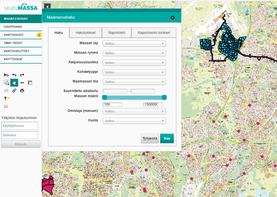 A screenshot of SeutuMassa.
SeutuMassa map service is maintained by HSY, who also has other map services implemented using Oskari.org’s open-source code. So, it was natural to continue with the proven software. Open software also offers independence from the application provider and the possibility to customize the system according to special needs.
SeutuMassa is based on the basic Oskari implementation to which the object drawing functionality and the search for soils and the reporting section have been added. The service is open to everyone, but more information and functions are available to logged-in users. SeutuMassa’s users and data producers in addition to HSY are the municipalities of Helsinki, Espoo, Vantaa.
The data presented in the service comes through interfaces, which enables us to present the most up-to-date information on a map. Soil data of Helsinki is read from Helsinki’s own interface into SeutuMassa, whereas the other two cities use SeutuMassa as their master tool for soil management. Master tool properties of SeutuMassa include, among other things, the possibility to both draw and write information on individual soil batches into SeutuMassa’s interface via SeutuMassa map Service. The strength of SeutuMassa lies in the visibility of information that is described regionally in the same way. This results from regional co-operation between the stakeholders, thus confirming that a single piece of data to be input into the system is suitable for the needs of all users. HSY develops the service together with the municipalities.
Use case examples:
- Planning, reviewing, adding and managing sites on the map is easy.
- Soil mass search. You can search for soil batches in the service according to their characteristics such as type of land, eligibility, and owner.
- Reporting. You can easily produce a summary report on the soil types of the planned sites and their quantities.